

Written By:
Aaron Bolshaw
Aaron is CMO at Frontline Data Solutions. He has spent 10 years building product and growth strategy for software in highly regulated markets, from financial reporting compliance at Certent to food safety and quality at SafetyChain, where he worked with manufacturers navigating FSMA and GFSI audits. Today he helps high-risk industrial operators simplify safety and compliance.
As demand for better incident tracking increases across high-risk industries, EHS software leader launches industry’s first custom image mapping tool.
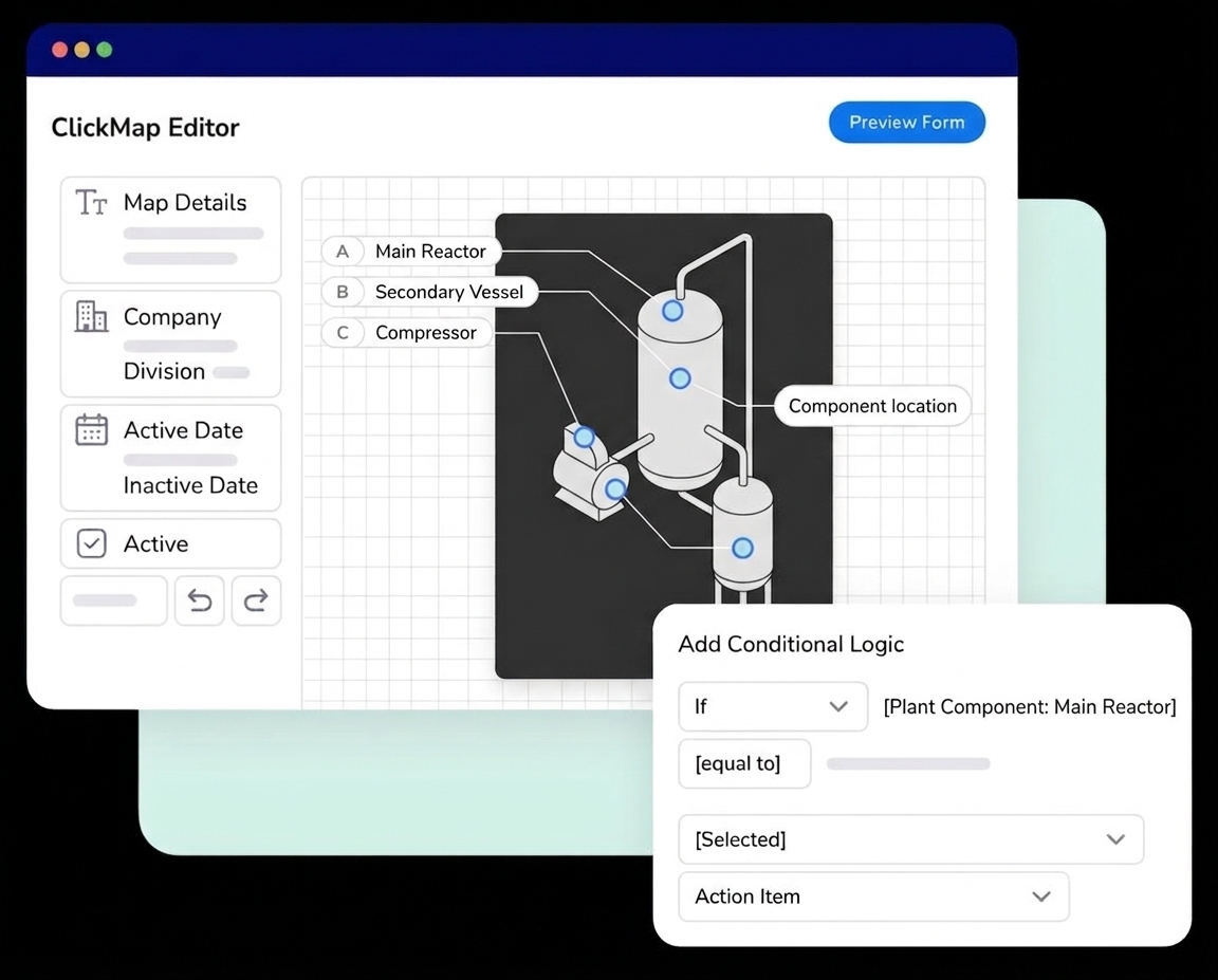
Frontline Data Solutions, a provider of user-friendly EHS (Environmental, Health, and Safety) software that simplifies safety operations, announced the launch of ClickMap, a new feature within its Action Tracking (ACT) and Management of Change (MOC) modules that lets frontline workers pinpoint incident and hazard locations visually instead of describing them in free text.
Incident reports often rely on written location fields, resulting in entries like “lower left forearm” or “northeast corner of Train 3.” These nonstandard descriptions are easy to misinterpret and difficult to trend. Instead, ClickMap lets users click directly on an image to mark an incident location, whether that be on a body or location in a facility.
Key capabilities of ClickMap include:
- Uploading any image to a form, with a default body map provided
- Drawing custom overlay maps directly on an uploaded image
- Using a body outline for injury reporting or a facility layout or equipment photo for event locations
- Saving overlay maps with the incident record
“Companies want to capture every incident and near miss,” said Ren Lu You, CEO at Frontline Data Solutions. “With ClickMap, instead of typing out an ambiguous text description, somebody can point at the exact spot on an image. It’s faster for the person filing the report and more useful for safety leaders reviewing data.”
ClickMap location data rolls up into custom reports that show where risk is concentrated. Leaders can spot recurring hazard areas so corrective action focuses on the places where incidents and near misses occur. It also works with conditional logic on the form. Admins can allow ClickMap to appear only when relevant, such as showing a facility layout for an OSHA event but hiding it for an admin report. This reduces the chance of a frontline worker skipping past a location field.
ClickMap is a faster process with better visual data than typical incident reports. Since it improves data accuracy, EHS leaders, safety managers, and process safety professionals can use precise locations for more accurate reporting and be more proactive with their programs. Better digitized incident tracking can reduce project risk by up to 80%.